|
|
Site Information |
|
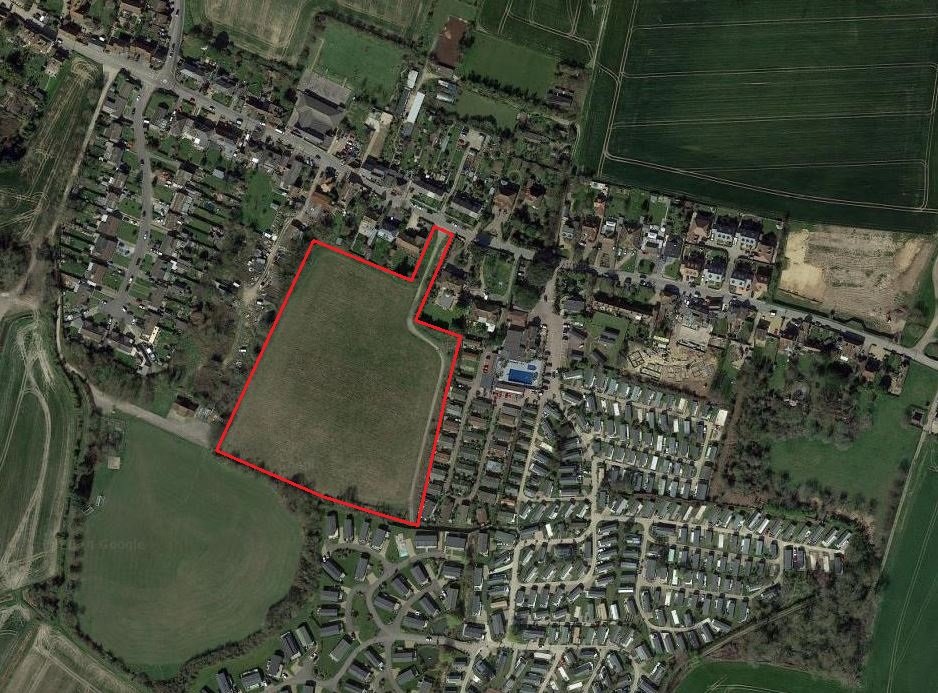
The Site is located in the village of Moknton, nearby to the town of Minster. |
|
Located in the Village of Monkton just over 5 miles from the seaside Town of Ramsgate, this Site benefits from great connectivity and agricultural landscapes.
The village is located at the south-west edge of the Isle of Thanet and is situated mainly along the B2047 road, leading off the A253 road between Canterbury and Ramsgate.
All of the Site is arable agricultural use, but currently is in a fallow state.
The Site is predominantly flat, but the land lies slightly lower in the South East. The land is relatively unconstrained, being free or environmental or historical delegations. Access to the Site is via Monkton Street, where a grassy verge currently sits. There is no road infrastructure in place to access the site at present.
The Site is located to the south of the Monkton Nature Reserve, found on the chalk hills to the north of the village. Five hundred metres to the south of the site sits a railway line which connects the nearby town of Minster to Sarre in the west, and Ramsgate in the east. |

